CNH-Care Platform

CNH-Care Platform

Overview

CLIENT NAME

INPACT ZONE

CATEGORY

ROLE

LINK

INACO Project Consortium

Central Europe

Gis, Research

Sub-contractor

CLIENT NAME

INACO Project Consortium

INPACT ZONE

Central Europe

ROLE

Sub-contractor

LINK

Project site, CNH-Care Platform

Info

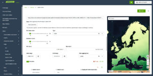
CNH-Care Platform is a tool for risk assessment of Cultural and Natural Heritage exposed to climate change induced hazards, designed and implemented in the framework of the Interreg Central Europe Project INACO. The platform provides a unified digital environment where public authorities, site managers and citizens can assess vulnerability, explore climate‑risk scenarios, and support coordinated adaptation strategies.
The Need

Climate change is intensifying hydro‑meteorological hazards: flash floods, landslides, storms, heatwaves, droughts, that increasingly threaten cultural and natural heritage located in river basin districts. Heritage sites need accessible ways to self‑assess vulnerability and engage communities in risk awareness. One of the project’s key objectives is to create a coherent environment, that brings together hazard data, vulnerability indicators, and participatory tools to support informed, site‑specific climate‑risk management.

The Solution

The CNH‑Care Platform provides an integrated digital environment that supports climate‑risk assessment and adaptation planning for CNH sites. It combines hazard layers, exposure information, and vulnerability indicators into an intuitive interface designed for both experts and non‑experts.

Its core components include:

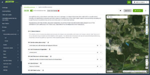
  • Vulnerability Assessment: a participatory tool for researchers and stakeholders to evaluate local climate risks. Using an expert-validated model, it scores structured questionnaires to generate transparent vulnerability ratings across Susceptibility, Exposure, and Resilience.
  • Risk Mapping Tool: is an interactive tool that allows users to visualise environmental factors, hazards and rank vulnerabilities. It enables the creation of customised maps by importing different data sources and thematic layers, each map tailored to a specific purpose and configurable as public or private. Thanks to its embedded‑sharing function, maps can also be hosted on external websites to support wider knowledge dissemination and decision‑making
  • Monitoring Statistics: provides an overview of platform‑wide activity by extracting aggregated statistics across all tools and user interactions. Although fully functional, it currently operates as a prototype with a limited set of indicators; as the platform begins to be used more consistently, emerging needs will guide the refinement and expansion of this section to deliver more targeted and meaningful analytics.

By integrating these features, the platform supports consistent, transparent, and scalable risk‑management workflows across diverse heritage contexts.

State of the Art

The CNH‑Care Platform is currently being deployed and tested across INACO’s pilot sites, which include river deltas, historic villages, archaeological areas, parks, and protected landscapes in Croatia, Italy, Austria, Hungary, Germany, Slovenia, the Czech Republic, Poland, and Slovakia. Early implementation demonstrates its capacity to harmonise heterogeneous datasets, support participatory vulnerability assessments, and provide actionable risk‑mapping tools. As the project progresses, the platform will continue to consolidate, ensuring it becomes a robust, transferable solution for climate‑risk management in CNH sites across Central Europe.
Development year: 2025
SHARE ON

SubRISK+Control Room

SubRISK+Control Room

Overview

CLIENT NAME

INPACT ZONE

CATEGORY

ROLE

LINK

SubRISK Projcet Consortium

Italy

Gis, Research

Sub-contractor

CLIENT NAME

SubRISK Projcet Consortium

INPACT ZONE

Italy

ROLE

Sub-contractor

LINK

Project site, Control Room

Info

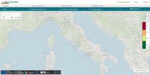
The SubRISK+ Control Room was developed within the SubRISK+ project framework to provide open, user‑friendly access to subsidence hazard and risk products. It integrates satellite data and risk indicators, enabling users to visualise, analyse, and monitor groundwater‑related land deformation across Italy.

The Need

Managing subsidence risk requires continuous monitoring, harmonized data, and tools that make complex geospatial information usable for public authorities, researchers, and technical operators. Before SubRISK+, subsidence‑related datasets were dispersed across institutions, produced with different methodologies, and difficult to compare or integrate. This fragmentation limited the ability to access consistent national‑scale subsidence information and visualize risk indicators in a clear, actionable way.

The project needed a unified digital environment capable of centralizing products, standardizing access, and enabling users to explore subsidence hazards and risks through a coherent, user‑friendly interface.

Solution

The SubRISK+ Control Room was developed as the project’s integrated digital platform, designed to consolidate subsidence‑related information and make it accessible through intuitive, interactive tools. Built around satellite InSAR time series and deformation maps, the SubRISK+ Control Room enriches raw observations with value‑added indicators, geological context, and exposure layers, transforming complex datasets into actionable insights.

Its core capabilities include:

  • Harmonized Data Access: single entry point for national‑scale subsidence products, ensuring consistency across regions and monitoring periods.
  • Interactive Visualisation Tools: dynamic maps, time‑series exploration, and thematic layers that allow users to analyse deformation patterns and risk factors.
  • Integrated Risk Indicators: value‑added metrics that combine deformation, geology, and exposure to support risk assessment and planning.
  • User‑Oriented Design: clear, accessible interface tailored to public authorities, researchers, and technical operators.

Through the Control Room, SubRISK+ transforms complex geospatial information into a coherent, operational tool that directly supports monitoring, planning, and risk mitigation activities.

State of the Art

The SubRISK Control Room is fully operational and hosts the project’s official subsidence hazard and risk products for Italy. It has demonstrated its capacity to integrate heterogeneous datasets, deliver reliable visualisation tools, and support consistent interpretation across regions. The platform is designed to evolve with future datasets, methodologies, and user needs, ensuring long‑term value for institutions and stakeholders engaged in land‑deformation analysis and risk management.

Development year: 2025

SHARE ON


ARES

Autonomous Remote Environmental Station

Overview

CLIENT NAME

INPACT ZONE

CATEGORY

ROLE

Ministero dell’Università e della Ricerca PNRR - VITALITY

Italia Appennino abruzzese, Nepal Valle del Khumbu

Research

Group Leader

CLIENT NAME

Ministero dell’Università e della Ricerca PNRR - VITALITY

INPACT ZONE

Italia Appennino abruzzese, Nepal Valle del Khumbu

ROLE

Group Leader

Info

ARES – Autonomous Remote Environmental Station è un progetto coordinato da INKODE SOC. COOP. È finanziato dal bando a cascata del PNRR VITALITY, Spoke 4 – Ambito Telemedicine and Environment – Indoor and outdoor atmosphere assessment (Università degli Studi ‘G. d’Annunzio’ di Chieti-Pescara).
VITALITY – Ecosistema di Innovazione, Digitalizzazione e Sostenibilità per l’Economia Diffusa nell’Italia Centrale è un progetto PNRR finanziato dal Ministero dell’Università e della Ricerca nell’ambito del Piano Nazionale di Ripresa e Resilienza (PNRR, Missione 4, componente 2, investimento 1.5).

Problema

Le aree montane sono considerate sentinelle del cambiamento climatico ed il progetto ARES mira a fornire uno strumento adeguato per monitorare la composizione dell’atmosfera. Il sistema, progettato per il monitoraggio della qualità dell’aria e del clima in ambienti montani, andrà a colmare un vuoto di mercato in questo settore a livello nazionale ed internazionale.

Soluzione

ARES sarà messo a punto con tecnologie all’avanguardia. Il sistema sarà integrato con un’innovativa piattaforma per la raccolta, la trasmissione e la gestione remota dei dati.Grazie a queste innovazioni, il dispositivo risulterà più versatile e funzionale. Sarà infatti possibile monitorare i parametri meteo e diverse sostanze inquinanti o climalteranti, tra cui CO_2, PM, Black Carbon e O_3. La soluzione include una stazione di monitoraggio progettata per la qualità dell’aria in ambienti esterni ed estremi. Il tutto è supportato da un nuovo sistema software e hardware per l’elaborazione e la distribuzione dei dati. Questa architettura garantisce sicurezza, affidabilità e privacy, assicurando al contempo la totale indipendenza dai servizi commerciali.

Stato dell’arte

Una prima fase di test e calibrazione avverrà presso i laboratori PROAMBIENTE e successivamente in quelli dell’Osservatorio climatico CNR di Mt. Cimone. Per il processo di validazione e verifica della affidabilità sul campo in ambiente outdoor montano, il sistema sarà impiegato in ambito nazionale in un’area dell’Appennino abruzzese mentre in ambito internazionale nella Valle del Khumbu in Himalaya, non lontano dal Nepal Climate Observatory – Pyramid.

Coordinatore: INKODE

Partner: PROAMBIENTE, EvK2Minoprio Srl – SIAVS

Durata: agosto 2024 – giugno 2025 (11 mesi)

Finanziamento: costo complessivo di 499.960,50 € e finanziamento di 429.960,50 €

CUP: D73C22000840006

SHARE ON


IHEMS

Indoor Health and Environment Monitoring System

Overview

CLIENT NAME

INPACT ZONE

CATEGORY

ROLE

Ministero dell’Università e della Ricerca PNRR - VITALITY

Italia centrale

Research

Partner

CLIENT NAME

Ministero dell’Università e della Ricerca PNRR - VITALITY

INPACT ZONE

Italia centrale

ROLE

Partner

Info

IHEMS – Indoor Health and Environment Monitoring System è un progetto coordinato da R13 TECHNOLOGY S.r.l. e finanziato dal bando a cascata del PNRR VITALITY, Spoke 4 – Ambito Telemedicine and Environment – Indoor and outdoor atmosphere assessment (Università degli Studi ‘G. d’Annunzio’ di Chieti-Pescara).

Problema

La scarsa qualità dell’aria negli ambienti indoor rappresenta una delle principali cause dell’incremento delle malattie cardiovascolari e respiratorie nella popolazione (OMS). Nei contesti indoor montani, le principali emissioni provengono dall’uso di biomasse per il riscaldamento. Al fine di affrontare questa sfida, il progetto propone l’implementazione e la validazione del sistema IHEMS (da TRL 7 a TRL 8).

Soluzione

IHEMS è una tecnologia sviluppata per monitorare simultaneamente l’inquinamento ambientale e i parametri fisiologici delle persone che vivono in ambienti confinati. Il monitoraggio ambientale si basa su misurazioni accurate di polveri sottili, Black Carbon e CO2, utilizzando strumenti di riferimento, per valutare attentamente le concentrazioni di questi inquinanti. Allo stesso tempo, il benessere degli individui è monitorato attraverso un dispositivo medico indossabile, in grado di rilevare la saturazione dell’ossigeno nel sangue, la frequenza cardiaca e la sua variabilità (ECG, HRV), il respiro e la temperatura cutanea. Le informazioni raccolte sono integrate e visualizzate in un cruscotto innovativo, che fornisce agli stakeholder una visione sinergica dei dati ambientali e medici in tempo reale.

Stato dell’arte

Il progetto si basa sull’esperienza dei partner coinvolti (R13, INKODE e PROAMBIENTE) nel campo della ricerca industriale e dell’innovazione tecnologica. Questa collaborazione permetterà di perfezionare e validare il sistema IHEMS e a potenziare l’attività produttiva nel contesto regionale di riferimento.
IHEMS è finanziato dallo stesso programma del progetto ARES che trova con esso importanti sinergie.
Mentre ARES prevede il monitoraggio meteo-climatico e della qualità dell’aria outdoor, IHEMS si focalizza sul monitoraggio della qualità dell’aria indoor, sia ambientale che fisiologico.
L’analisi dei dati incrociati dei due progetti può permettere l’individuazione di importanti correlazioni tra misure di qualità dell’aria outdoor, indoor e parametri vitali, migliorando così la conoscenza e la comprensione riguardo la composizione e la caratterizzazione dell’inquinamento atmosferico in ambienti remoti e confinati, ed i suoi effetti sulla salute.

Coordinatore: R13 TECHNOLOGY S.r.l.

Partner: PROAMBIENTE, INKODE

Durata: agosto 2024 – giugno 2025 (11 mesi)

Finanziamento: costo complessivo di 499.975,50 € e finanziamento di 429.962,60 €

SHARE ON


AQUARIUS

Aqua Research Infrastructure Services for the health and protection of our unique, oceans, seas and freshwater ecosystems

AQUARIUS

Overview

CLIENT NAME

INPACT ZONE

CATEGORY

ROLE

LINK

European Union’s Horizon Europe Framework Programme for Research and Innovation

Atlantic-Artic, Baltic e North Sea, Danube e Black Sea, Mediterranean Sea

AI, Enterprise Software, Research

Partner

CLIENT NAME

European Union’s Horizon Europe Framework Programme for Research and Innovation

INPACT ZONE

Atlantic-Artic, Baltic e North Sea, Danube e Black Sea, Mediterranean Sea

ROLE

Partner

LINK

Project Site, Resources and Outputs

Info

AQUARIUS is a four‑year Horizon Europe project bringing together 45 partners to integrate and harmonize marine and freshwater research infrastructures across Europe. It provides access to 57 advanced services, including vessels, drones, satellites, sensors, and data systems, enabling cutting‑edge environmental research.
The project directly supports major EU priorities: the Mission to Restore our Ocean and Waters, the European Green Deal, and the development of the Digital Twin of the Ocean.
Covering Europe’s major seas and river basins, AQUARIUS focuses on restoring biodiversity, eliminating pollution, and building a sustainable, carbon‑neutral blue economy. Researchers can access its infrastructures through open funding calls, supported by training activities and open‑data principles that foster collaboration and accelerate solutions for healthier aquatic ecosystems worldwide.

The Need

Large, multi‑partner research infrastructures like AQUARIUS face a critical challenge: efficiently managing Transnational Access (TA) and Remote Access (RA) across highly diverse assets. The access process requires a robust, compliant, centralized digital system capable of handling the full lifecycle of access calls, from application submission and expert evaluation to complex scheduling and EU‑compliant reporting. Existing systems were typically fragmented and ad‑hoc, lacking essential features such as:

  • a consolidated RI management interface
  • advanced, customizable reporting modules
  • standardized scheduling across heterogeneous infrastructures
  • secure, centralized authentication and role management

Given AQUARIUS’s scale, the consortium urgently needed a single, integrated platform to ensure operational coherence, compliance, and efficiency in managing TA/RA activities.

The Solution

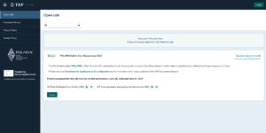
The Transnational Access Platform (TAP) is the advanced digital solution developed to meet these challenges. Evolving from the INTERACCESS platform, TAP delivers a customizable yet standardized all‑in‑one system for managing the entire TA/RA workflow.

Key TAP capabilities include:

  • Call Management: Full lifecycle support from call opening to grant issuance and final reporting.
  • Access Booking System: A harmonized scheduling engine capable of comparing and standardizing diverse booking methods across all AQUARIUS infrastructures.
  • Document Sharing System: A secure library for guidelines, templates, and project documents with configurable confidentiality levels.
  • EU‑Compliant Reporting: Automated, precise, and customizable reporting aligned with European Commission requirements.
  • Secure Authentication: Centralized identity and permission management via Keycloak.

State of the Art

TAP has already supported two full TA/RA calls within AQUARIUS and is fully prepared to manage the next two incoming ones. TAP has demonstrated the reliability, flexibility, and operational coherence needed to manage complex access workflows. Its selection as the official TA management system for AQUARIUS confirms its capacity to streamline processes, integrate best practices, and support large‑scale, multidisciplinary research infrastructures.

Coordinator: Marine Institute Foras na Mara

Partners: Corsortium page

Duration: 01 March 2024 – 29 February 2028 (4 years)

Funding: Net EU contribution € 2 200 616,25 – Total cost € 2 200 616,25

GA: 101130915

SHARE ON


POLARIN

Polare Research Infrastructure Network

POLARIN

Overview

CLIENT NAME

INPACT ZONE

CATEGORY

ROLE

LINK

European Union’s Horizon Europe Framework Programme for Research and Innovation

Arctic and Antarctic

AI, Enterprise Software, Research

Partner

CLIENT NAME

European Union’s Horizon Europe Framework Programme for Research and Innovation

INPACT ZONE

Arctic and Antarctic

ROLE

Partner

LINK

Project Site

Info

POLARIN is a Horizon Europe project designed to unify and strengthen Europe’s polar research capacity by connecting Arctic and Antarctic infrastructures into a coherent, accessible system. It brings together stations, vessels, observatories, data services, and long‑term archives to support high‑quality research on the rapid environmental changes unfolding at both poles. By improving access, interoperability, and data integration, POLARIN enables scientists to investigate climate processes, ecosystem shifts, and cryosphere dynamics with greater precision. The project also invests in training, safety, and community development to ensure that researchers can work effectively in extreme environments. Through coordinated services and shared standards, POLARIN enhances Europe’s ability to monitor polar change, support evidence‑based policy, and contribute to global climate knowledge.

The Need

Polar research infrastructures operate across remote regions, harsh conditions, and diverse national systems, making coordinated access and data use difficult. Researchers face fragmented procedures, incompatible digital tools, and limited interoperability, which slow planning and reduce scientific efficiency. Key challenges include:

  • dispersed access workflows
  • limited system interoperability
  • strong logistical and seasonal constraints
  • no unified TA/RA management framework
  • a consolidated RI management interface
  • advanced, customizable reporting modules

POLARIN addresses these structural gaps by creating a coherent, integrated access and data ecosystem for polar science.

The Solution

To address the fragmentation and operational complexity that characterise polar research infrastructures, the Transnational Access Platform (TAP) was used as the unified digital environment supporting POLARIN’s access management. TAP streamlines the entire TA/RA lifecycle by replacing dispersed procedures with a single, coherent system where proposals, evaluations, logistics, documentation, and reporting follow harmonized workflows. This reduces administrative burden, improves transparency, and ensures consistent compliance across infrastructures operating under different national frameworks.

TAP also mitigates the logistical constraints of polar operations. Its integrated booking engine accounts for availability, seasonal windows, and operational limitations, enabling realistic planning across research infrastructures. A secure document space centralizes guidelines, permits, and safety materials, while automated reporting ensures alignment with EU requirements. Authentication and role management are handled through a robust identity system that supports multi‑institution collaboration and protects sensitive information.

Through TAP, POLARIN benefits from a connected, efficient access ecosystem that directly addresses its structural needs and supports high‑quality polar science.

State of the Art

TAP has already supported two POLARIN full TA/RA calls and two core repository calls and is fully prepared to manage the futures incoming calls. TAP has demonstrated the reliability, flexibility, and operational coherence needed to manage complex access workflows. Its selection as the official TA management system for POLARIN confirms its capacity to streamline processes, integrate best practices, and support large‑scale, multidisciplinary research infrastructures.

Coordinator:  AWI

PartnersCorsortium page

Duration: 01 March 2024 – 28 February 2029 (5 years)

Funding: Net EU contribution € 14 588 116,68 – Total cost € 14 588 116,68

GA: 101130949

SHARE ON


Itinerari Digitali

Itinerari Digitali

Overview

CLIENT NAME

INPACT ZONE

CATEGORY

ROLE

LINK

Istituto Centrale per il Catalogo e la Documentazione - ICCD

Italia

Gis, Research, Visual

Partner

CLIENT NAME

Istituto Centrale per il Catalogo e la Documentazione - ICCD

INPACT ZONE

Italia

ROLE

Partner

LINK

Sito web

Info

Obbiettivo del progetto

Itinerari Digitali nasce nell’ambito delle attività dell’ ICCD Istituto Centrale per il Catalogo e la Documentazione del Ministero della Cultura, finanziate dal Fondo Europeo di Sviluppo Regionale attraverso il programma PON Cultura e Sviluppo 2014/2020.
Il progetto si inserisce in una strategia più ampia di valorizzazione del patrimonio culturale italiano, soprattutto è finalizzato alla documentazione, catalogazione e valorizzazione delle regioni Basilicata, Calabria, Campania e Puglia.
Ha come obiettivo riconnettere una molteplicità di beni sul territorio (centri ed edifici storici, architetture rurali, manifestazioni materiali e immateriali di un paesaggio culturale), attraverso l’organizzazione di itinerari anche con destinazioni di minore richiamo mediatico e affluenza turistica.

Soluzione innovativa

Realizzazione di una piattaforma geografica innovativa. Si considera di importanza primaria la documentazione puntuale del patrimonio immobile e mobile, rilevato e restituito nella complessità di un unico sistema culturale e paesaggistico.

Partecipazione attiva dell’utente

la piattaforma non si limita ad offrire un ambiente di consultazione del patrimonio culturale.
La partecipazione attiva degli utenti rappresenta uno degli elementi più innovativi, ma invita cittadini, studiosi, turisti e comunità locali a contribuire direttamente alla costruzione e all’arricchimento dei contenuti.
Questo approccio collaborativo trasforma il portale in uno spazio dinamico, in cui la documentazione scientifica si integra con narrazioni, esperienze e testimonianze provenienti dal territorio. Ogni contributo viene sottoposto a un processo di verifica, garantendo la qualità e l’affidabilità delle informazioni pubblicate.
Grazie al coinvolgimento attivo degli utenti, la piattaforma diventa un ecosistema aperto, in continua evoluzione, capace di connettere competenze istituzionali, conoscenze locali e pratiche di cittadinanza attiva.

L’identità visiva

La realizzazione dell’identità visiva per un progetto come Itinerari Digitali ha richiesto un equilibrio sottile tra due mondi: quello fisico (il territorio, l’esplorazione, il percorso) e quello tecnologico (l’innovazione, l’accessibilità, il futuro).
L’idea centrale è stata la connessione e la metafora visiva Il “punto” (nodo di una rete o punto sulla mappa) che si trasforma in una linea (il percorso). Il sistema visivo non si limita a “vestire” il progetto, ma ne costituisce l’infrastruttura percettiva.
Attraverso il passaggio dal punto alla linea, abbiamo creato un linguaggio capace di raccontare Il viaggio non più solo come una destinazione, ma una sequenza di nodi intelligenti che, uniti, formano una nuova mappa della conoscenza.

Programma Operativo Nazionale: Cultura e Sviluppo 2014/2020

Finanziamento: € 138.478.00

SHARE ON


FAIRSEA and TECHERA

ITALY CROATIA CROSS-BORDER COOPERATION PROGRAMME - Interreg

FAIRSEA and TECHERA

Overview

CLIENT NAME

INPACT ZONE

CATEGORY

ROLE

LINK

Interreg Europe

Adriatic Sea

Big Data, Gis, Research, Visual

Developer

CLIENT NAME

Interreg Europe

INPACT ZONE

Adriatic Sea

ROLE

Developer

LINK

Interreg Italy-Croatia, FAIRSEA Project, TECHERA Project

Info

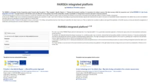
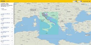
FAIRSEA and TECHERA Interreg projects form a complete cycle of innovation in the Adriatic Sea. FAIRSEA laid the scientific foundations for a shared ecosystem approach to fisheries, while TECHERA capitalized and expanded those results into a new technological era of big‑data sharing, digital tools, and low‑carbon solutions for the blue economy. Together, they produced a unified legacy: the FAIRSEA Integrated Platform, a cross‑border digital environment that brings together biological, ecological, and fisheries dynamics to support evidence‑based management and innovation.

The Need

The Adriatic Sea is a shared ecosystem where environmental processes, fish stocks, and socio‑economic activities cross national boundaries. Effective management requires:

  • shared data
  • common indicators
  • interoperable tools
  • cross‑border cooperation
  • accessible interfaces for scientists, managers, and stakeholders

FAIRSEA addressed the scientific need: creating a common ecosystem‑based management framework. TECHERA addressed the technological need: transforming FAIRSEA’s outputs into operational digital tools and expanding them with big‑data, innovation, and low‑carbon approaches.

The Solution

FAIRSEA The scientific foundation. Developed the ecosystem models, knowledge base, and participatory processes needed to support sustainable fisheries management. Its main achievement is the FAIRSEA Integrated Platform, which integrates:

  • biological and ecological processes
  • water mass circulation and physical‑chemical properties
  • plankton productivity
  • resource dynamics and species interactions
  • fisheries bio‑economic behaviour

This platform allows users to explore scenarios, test policies, and evaluate sustainability trade‑offs.

TECHERA updated and expanded the FAIRSEA platform, integrating it into a broader technological ecosystem. It introduced:

  • big‑data sharing and analytics
  • digital applications for fisheries and markets
  • ecological indicators for product certification
  • VR and gaming tools for education
  • clustering activities connecting multiple Adriatic projects

TECHERA transformed FAIRSEA’s scientific backbone into a set of operational, transferable, and technology‑driven solutions.

State of the Art

FAIRSEA and TECHERA together delivered a wide range of rsults from a robust ecosystem‑based management framework and interoperable digital tools to practical guidelines for sustainable fisheries, innovative educational and communication formats, cross‑border cooperation models, and evidence‑based recommendations for future programming periods. Even though both projects have concluded, their outputs remain active and relevant for Adriatic initiatives and ongoing blue‑economy innovation.

SHARE ON