SubRISK+Control Room
Overview
CLIENT NAME
INPACT ZONE
CATEGORY
ROLE
LINK
CLIENT NAME
SubRISK Projcet ConsortiumINPACT ZONE
ItalyROLE
Sub-contractor
LINK
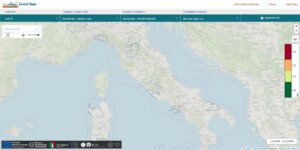
Project site, Control RoomInfo
The SubRISK+ Control Room was developed within the SubRISK+ project framework to provide open, user‑friendly access to subsidence hazard and risk products. It integrates satellite data and risk indicators, enabling users to visualise, analyse, and monitor groundwater‑related land deformation across Italy.
The Need
Managing subsidence risk requires continuous monitoring, harmonized data, and tools that make complex geospatial information usable for public authorities, researchers, and technical operators. Before SubRISK+, subsidence‑related datasets were dispersed across institutions, produced with different methodologies, and difficult to compare or integrate. This fragmentation limited the ability to access consistent national‑scale subsidence information and visualize risk indicators in a clear, actionable way.
The project needed a unified digital environment capable of centralizing products, standardizing access, and enabling users to explore subsidence hazards and risks through a coherent, user‑friendly interface.
Solution
The SubRISK+ Control Room was developed as the project’s integrated digital platform, designed to consolidate subsidence‑related information and make it accessible through intuitive, interactive tools. Built around satellite InSAR time series and deformation maps, the SubRISK+ Control Room enriches raw observations with value‑added indicators, geological context, and exposure layers, transforming complex datasets into actionable insights.
Its core capabilities include:
- Harmonized Data Access: single entry point for national‑scale subsidence products, ensuring consistency across regions and monitoring periods.
- Interactive Visualisation Tools: dynamic maps, time‑series exploration, and thematic layers that allow users to analyse deformation patterns and risk factors.
- Integrated Risk Indicators: value‑added metrics that combine deformation, geology, and exposure to support risk assessment and planning.
- User‑Oriented Design: clear, accessible interface tailored to public authorities, researchers, and technical operators.
Through the Control Room, SubRISK+ transforms complex geospatial information into a coherent, operational tool that directly supports monitoring, planning, and risk mitigation activities.
State of the Art
The SubRISK Control Room is fully operational and hosts the project’s official subsidence hazard and risk products for Italy. It has demonstrated its capacity to integrate heterogeneous datasets, deliver reliable visualisation tools, and support consistent interpretation across regions. The platform is designed to evolve with future datasets, methodologies, and user needs, ensuring long‑term value for institutions and stakeholders engaged in land‑deformation analysis and risk management.
Development year: 2025